
Sky High Art: Exploring the Alternative World of Satellite Imagery for Artists
ART, earth
Landsat 8 orbits 305 km above the Earth and captures in excess of 700 scenes per day
In recent years satellite imagery has become an increasingly popular tool for artists looking to capture the world from a unique perspective. With advancements in technology, high-resolution satellite images can now be captured from thousands of miles above the earth's surface, providing a breathtaking view of our planet's natural and man-made landscapes.
In this post we’ll explore the intersection of art and satellite imagery, looking at how artists such as Richard John Seymour, British born BAFTA-nominated filmmaker and visual artist, are using this medium to create stunning visual representations of our world.
From abstract compositions to hyper-realistic depictions, satellite imagery is proving to be a powerful tool in the hands of creative minds. Let's delve into the world of satellite imagery as a form of art and discover the beauty and potential of this emerging medium.
Seymour's Latest Artistic Creations
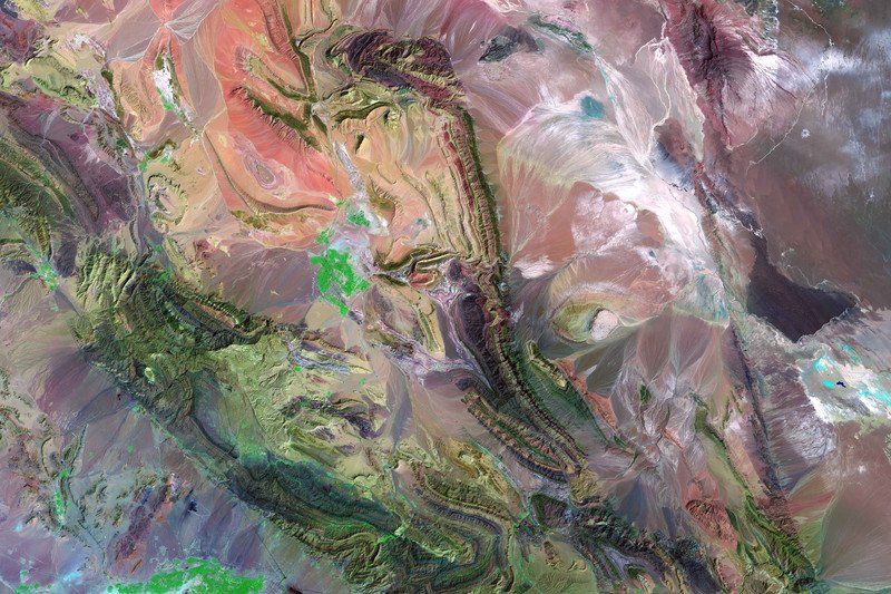
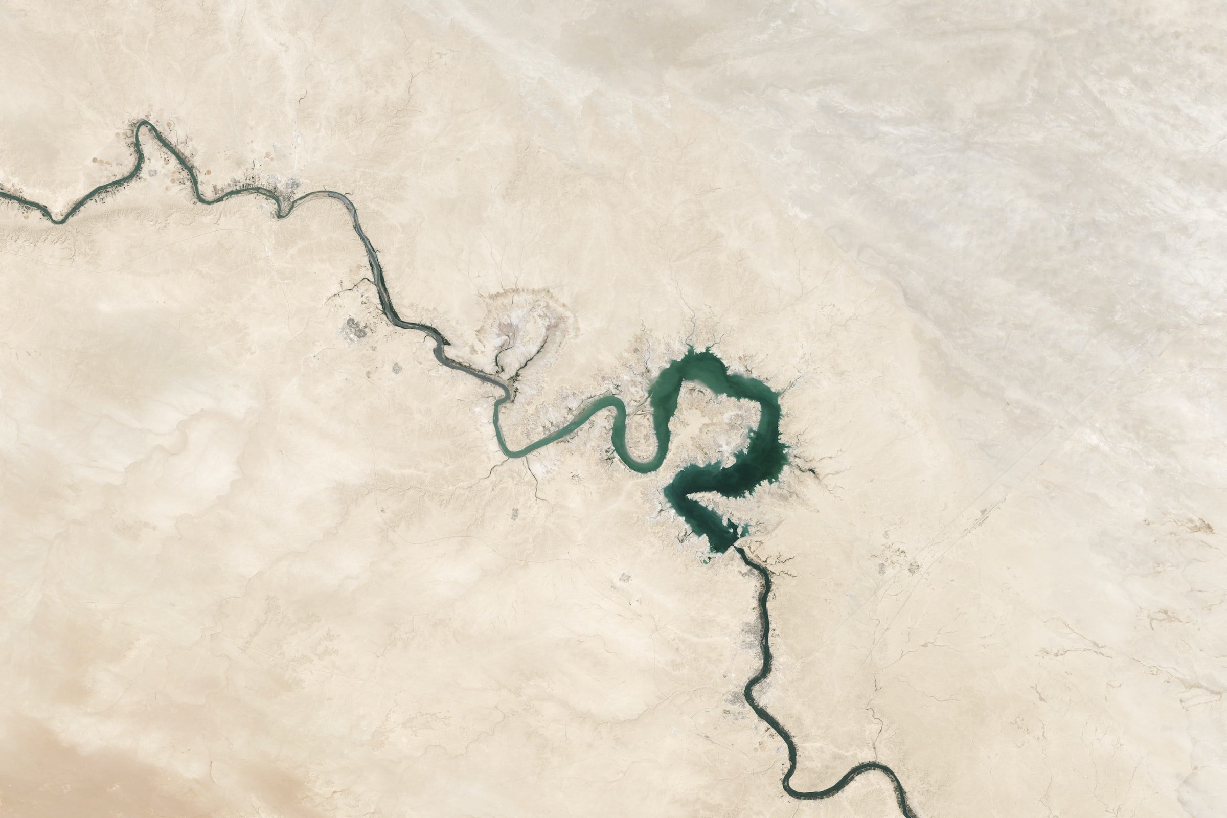
Titled Landsat Works are an acclaimed series that incorporate data captured by the Landsat 8 satellite. Landsat 8 is a satellite that has been jointly developed and managed by NASA and the United States Geological Survey (USGS).
This collaboration was formed with the goal of creating a powerful and reliable tool for capturing high-quality imagery of the Earth's surface. Landsat 8 is equipped with advanced sensors and imaging technologies that allow it to capture detailed images of the planet, including land, water and atmospheric conditions.
The data collected by Landsat 8 is used by scientists and researchers in a range of scientific and industrial fields, including agriculture, hydrology or forestry. For instance, Landsat 8 data can be used to monitor crop health, track the growth of forests, and measure changes in the Earth's water resources. In addition, Landsat 8 data is also used for urban planning, disaster response and national security purposes.
Landsat Works not only commemorates the magnificence of nature but also underscores the pressing need to safeguard it at any expense, as is typical of Seymour's prior endeavors. Seymour ingeniously adapted false-color image processing techniques from the mineral prospecting sector for this project, thereby emphasizing how surveillance technology is frequently employed to manipulate and exploit the environment.
IN SUMMARY
Landsat Works unveil the hidden realm of data that technology unveils about our planet and captivate the audiences with vibrant tapestries. The aim is to raise awareness about the growing influence of technology on the environment and its potential repercussions.
Overall, the collaboration between NASA and USGS in developing and managing Landsat 8 has been instrumental in providing high-quality data that has numerous applications in various scientific, industrial and even creative fields.
The continuous stream of data collected by Landsat 8 over the years has allowed for a more in-depth understanding of the Earth's surface and has helped shape policies related to environmental management and sustainability while in recent years enforced and inspired artists to reach alternatives medium in their creative exploration.
***


A stark contrast between the public image of tradition and civic pride, and the reality of a city grappling with profound economic and social inequality.